


Need authorization agreement
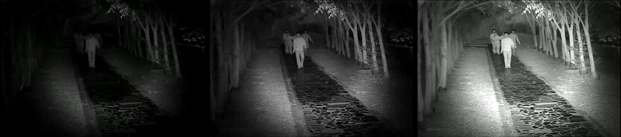
MI3 (Multi-Intensity Infrared Illumination) Database
Surveillance video captured by Multi-intensity infrared illuminator.
GT(ground-truths) :bounding boxes of 'person' in channel 2,4 and 6 by following the Pascal VOC format.
©NCTU ISlab
Reference
- C.-H. Chan, H.-T. Chen, W.-C. Teng, C.-W. Liu, J.-H. Chuang, "MI3: Multi-Intensity Infrared Illumination Video Database," IEEE Int'l Conf. on Visual Communications and Image Processing (VCIP), Singapore, Singapore, Dec. 13-16, 2015.
データとリソース
追加情報
| フィールド | 値 |
|---|---|
| 作成者 | cvrc-nctu-edu-tw |
| メンテナー | |
| 最終更新 | 9月 26, 2025, 10:41 (CST) |
| 作成日 | 12月 26, 2019, 14:28 (CST) |
| 盧沛怡小姐 | 1503054@nchc.narl.org.tw |
| DOI | 10.30193/scidm-ds-h939c6t |
Citation
推薦資料集: